


Add Your Heading Text Here
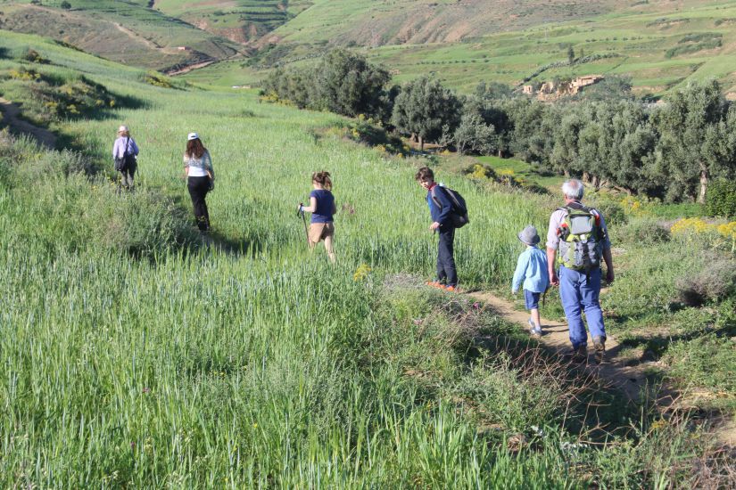
The High Atlas, the largest mountain range in North Africa, is home to some of Morocco’s most captivating and picturesque areas. Acting as both a historical and physical divide between the northern plains and the pre-Sahara, the Berber-inhabited valleys here offer a sense of isolation, distinct from the hustle and bustle of urban Morocco. This region stands as North Africa’s premier trekking destination, with trails that appeal to both casual day hikers and experienced mountaineers. The landscape features towering peaks (jebels) and well-known mountain passes (tizis or cols in French), providing various routes to explore. Located just a short distance from the lively city of Marrakesh, Toubkal National Park is home to the towering Jebel Toubkal (4167m) and a collection of villages that seem to be frozen in time. Besides the highest peak, there are several other notable summits and villages to explore with the help of a knowledgeable guide.
- The Agoundis Valley
- Amizmiz and Ait Zitoun
- High Atlas Berbers
- Ijoukak
- Ouirgane
- Oukaïmeden
- Tizi n’Test
- The Toubkal Massif
- The Ourika Valley
- Weather and affected routes
- Oukaïmeden
- Tassa Ouirgane
The area’s appeal goes beyond the mud-brick Berber villages and remote mountain tops. The landscape undergoes dramatic changes throughout the year: winter brings heavy snow, turning the rivers into rushing torrents by spring; summer presents intense heat, while autumn paints the mountains in rich reds and browns.
Trekking in the region offers a chance to explore unburdened, as muleteers and their mules can be hired to carry gear. Mountain guides are highly recommended, especially if venturing off the main trails. For the adventurous, rock climbing, ski mountaineering, and mountain biking along the rugged pistes and mule tracks are also popular activities.
The Agoundis Valley
Located to the east of Ijoukak, the Agoundis Valley offers an alternative route to Toubkal. Reaching the Toubkal Refuge from Ijoukak requires two days of strenuous trekking. To begin, follow the Marrakesh road from Ijoukak, cross the Oued Agoundis riverbed, and take a right turn onto the up-valley road, passing several gîtes along the way. The scenery gradually opens up to reveal distant peaks, with numerous villages scattered throughout. After walking for about an hour, you’ll come across the remains of an old mineral processing plant, with a gondola still suspended on a cable stretched across the valley, linking to now-defunct mines. Continue to the village of Taghbart, where a fork in the road leads you to the right to cross the river. This path ascends impressively toward the 2202-meter Tizi-n-Ou-Ichddane on the Atlas watershed. The Agoundis piste then passes El Makhzen and a distinctive house styled like a wedding cake before narrowing and becoming more rugged, with perched villages along the way, eventually reaching the village of Aït Youl.
From Aït Youl, experienced trekkers can reach the Toubkal Refuge in a day, crossing the Tizi n’Ougane (which may have snow on its final slopes from November to May), navigating wild gorges and scree slopes.

Amizmiz and Ait Zitoun
The small, dusty town of Amizmiz, located 58km from Marrakesh, hosts one of the Atlas’ largest Berber markets, held every Tuesday. Although not a major tourist destination, it is an interesting stop, featuring distinct quarters, including a zaouia, kasbah, and former Mellah, separated by a dry riverbed. Amizmiz is an excellent base for mountain biking in the High Atlas.
A short distance away, the village of Ait Zitoun offers a more authentic starting point for treks compared to Amizmiz. Here, you can arrange mules, supplies, and a local guide. Ait Zitoun is a bit tricky to find; it lies off the main road from Amizmiz to Ouirgane, accessible via a short piste (look for a sign stating “Gîte Ait Zitoun”). A walk from here to Ouirgane, lasting three to four days, is best undertaken in the cooler months. The path mostly stays at a low altitude, winding through green hills in spring and brown in summer and autumn. While the trek is mostly moderate, it does include some steep inclines near the ridges.
Alternatively, Lalla Takerkoust, located 22km northeast of Amizmiz, offers a scenic overnight stop with beautiful lake views framed by snow-capped mountains, especially in winter. The area is dotted with villages, and a short walk to nearby low hills offers excellent panoramic views.
Mountain Biking – Routes from Amizmiz
Morocco is known for offering some of the best adventure biking in the world, with routes suitable for all levels. The High Atlas has numerous jeep and mule tracks, and several adventure companies organize mountain biking trips. When traveling independently, respect for local customs is essential-ride slowly through villages, yielding to people, especially those on mules or children tending animals. If renting a bike, make sure to negotiate for essentials like a pump, puncture repair kit, or a spare inner tube. A helmet is advised, and it’s crucial to carry enough water.
Below are three biking routes, with the first two suitable for novices with rented bikes, while the third is best suited for experienced riders, preferably on their own bikes. All routes start and end at Restaurant Le Source Bleu, located above Amizmiz in Irghagn. Since few roads are signposted, the Amizmiz 1:100,000 topographical map is highly recommended for navigation.

Route 1: The Oued Anougal Circuit
Start at Le Source Bleu, descend to the piste road leading from Amizmiz to Azegour, and then head uphill past the Maison Forestière. After about 1.5km, take a narrow piste left down the west side of the valley, passing the village of Aït Ouskri, offering stunning views of Jebel Gourza and Jebel Imlit. Continue on the piste, passing through Tizgui, Toug al Kheyr, and after 10km, Imi-n-Isli and Imi-n-Tala. After crossing the Anougal River below Addouz, follow the piste through Imzayn, sticking to the lower track, and reach Igourdan. After about 12km uphill, you will reach Aït Hmad. From there, the piste widens, allowing for a fast descent back to Amizmiz
Below are three biking routes, with the first two suitable for novices with rented bikes, while the third is best suited for experienced riders, preferably on their own bikes. All routes start and end at Restaurant Le Source Bleu, located above Amizmiz in Irghagn. Since few roads are signposted, the Amizmiz 1:100,000 topographical map is highly recommended for navigation.
Route 2: Jebel Timerghit Circuit
Start at Le Source Bleu, descend to the piste road leading from Amizmiz to Azegour, and then head uphill past the Maison Forestière. After about 1.5km, take a narrow piste left down the west side of the valley, passing the village of Aït Ouskri, offering stunning views of Jebel Gourza and Jebel Imlit. Continue on the piste, passing through Tizgui, Toug al Kheyr, and after 10km, Imi-n-Isli and Imi-n-Tala. After crossing the Anougal River below Addouz, follow the piste through Imzayn, sticking to the lower track, and reach Igourdan. After about 12km uphill, you will reach Aït Hmad. From there, the piste widens, allowing for a fast descent back to Amizmiz
Below are three biking routes, with the first two suitable for novices with rented bikes, while the third is best suited for experienced riders, preferably on their own bikes. All routes start and end at Restaurant Le Source Bleu, located above Amizmiz in Irghagn. Since few roads are signposted, the Amizmiz 1:100,000 topographical map is highly recommended for navigation.
Route 3: Toulkine Descent
Start as in the previous routes but continue straight ahead past the turnoff to Route 1. Trek through the forest to the gentler crest, descending into the Erdouz-Wadakar valley, where you’ll find ruins from former mining operations. After crossing the bridge, turn right to circle around Toulkine. Follow a mule track that heads north, winding through the Jebel Aborji forest before descending steeply to the plains at Tiqlit. It’s advisable to check the route at Toulkine before heading out.
High Atlas Berbers
Until relatively recently, the High Atlas region and its Berber inhabitants remained largely isolated. When the French began their “pacification” of Morocco in the 1920s, the region’s way of life was almost entirely feudal, with control over the three main passes (tizis) held by a trio of powerful “clan” families, known as the “Lords of the Atlas.” Even after the French secured the cooperation of these warrior chiefs, it wasn’t until the spring of 1933—over 20 years after the establishment of the Protectorate—that they managed to subdue them and take control of the tribal land. This was achieved with the help of T’hami el Glaoui, the feudal chief who continued to rule the region as pasha of Marrakesh.
Today, the region is under government control through local caids, though in many villages the influence of the state is minimal. Visitors trekking through the mountains will soon discover the area’s unique culture and traditions. The Atlas Berbers, the longest-established inhabitants of Morocco, never fully embraced orthodox Islam, and the Arabic language has had little impact on their native Tachelhaït dialects. Their music, the distinctive ahouache dances, and village architecture—featuring stone or clay houses stacked on rocky slopes, fortified agadirs (communal granaries), and kasbahs, which once served as castles for community defense—are all unique to the region.
In the Atlas, Berber women enjoy a more visible role compared to rural women in the plains and northern regions. They partake in much of the labor, including farming, herding livestock, and carrying large loads of brushwood and supplies. However, it’s unclear whether they hold more power or status within the family or village. Men typically handle tasks deemed more important, such as trading goods, nighttime crop irrigation, plowing, and building.
Despite the tough life in the mountains, visitors are often struck by the Berbers’ friendliness and openness. Many are multilingual, speaking French, English, or both. In popular trekking areas like Jebel Toubkal, however, the presence of tourism can sometimes lead to a sense of exploitation, particularly with children seeking attention in exchange for small favors.

Ijoukak
Ijoukak serves as an important shopping hub where the Agoundis Valley meets the Nfis. From Ijoukak, you can explore nearby sites like Tin Mal and Talaat n’ Yakoub, or embark on longer treks in the Nfis and Agoundis valleys. A day’s wander in the Agoundis Valley is enjoyable, and you can take a forestry road up the hill dominating the village for a panoramic view.

Tin Mal Mosque
The Tin Mal Mosque, not only historically and architecturally significant, is also set in a stunning location, nestled above a lush river valley with dramatic mountains in the background. The mosque has undergone partial restoration and is well worth a visit.
Located a short distance uphill from the modern village of Tin Mal (also known as Ifouriren), the mosque is typically locked, but the gardener will quickly let you in for a look (a tip is expected).
Brief History


The Tin Mal Mosque was completed by Abd el Moumen around 1153–54, initially built as a Koranic school (tinmil means “school” in ancient Berber) by Ibn Toumert in 1125, and later as his family’s mausoleum. The mosque was fortified and likely served as part of the town’s defenses. In the early period of Almohad rule, Tin Mal housed the state treasury. Today, the mosque remains the only identifiable structure from the original Almohad city, which was largely destroyed during the Merenid conquest of 1276.
That the mosque remained intact for so long speaks volumes about the enduring influence of Ibn Toumert’s teachings on the local Berbers. Even two centuries later, the historian Ibn Khaldun noted that Koranic readers still worked at the mosque, and when the French began restoration in the 1930s, they found the site covered in the shrines of marabouts.
The Interior
Architecturally, Tin Mal offers a rare opportunity for non-Muslims to view the interior of a traditional Almohad mosque. While the mosque is largely roofless and two of the corner pavilions are missing, the mihrab (prayer niche) and intricate internal arches are still well-preserved. The design follows the classic Almohad T-shaped layout, with a central aisle leading to the mihrab, similar to that of the Koutoubia Mosque in Marrakesh. One distinctive feature is the placement of the minaret above the mihrab, a design flaw that kept it relatively short. The most striking aspect of the decoration is the elaborate arches, particularly those around the mihrab, which feature beautiful stalactite vaulting. This technique is extended to the corner domes and the mihrab vault, creating an impressive effect. Geometric patterns and familiar Almohad motifs, such as palmettes, rosettes, and scallops, dominate the design, adding to the mosque’s austere beauty.


Ibn Toumert and the Almohads
Tin Mal, a quiet site now, might seem like an unlikely place for a historical stronghold. Yet, it was here that Ibn Toumert and his lieutenant, Abd el Moumen, initiated the Almohad movement—one of the most significant religious and political movements in Morocco’s history. The movement began as a response to the luxury and perceived corruption of the Almoravid dynasty, which controlled Morocco at the time. Ibn Toumert, who would come to be known as the Mahdi, or “The Chosen One,” believed that Islam had strayed from its core principles.
Born in the High Atlas Mountains into the Berber Masmouda tribe, Ibn Toumert became a scholar and theologian. He studied in the eastern centers of Islam, where he formulated the doctrines that would later define the Almohad movement. The Almohads were radical in their rejection of certain practices in Islam, including the veneration of saints and the mixing of men and women in public spaces. Their slogan, “There is no god but God,” emphasized strict monotheism and a rejection of idol worship, including the excessive luxury enjoyed by the ruling classes.
Ibn Toumert began his mission by preaching in the Atlas Mountains, rallying the Berber tribes to his cause. He argued that the Almoravids had corrupted the true teachings of Islam and were unworthy of leading Morocco. In 1124, after being exiled from Marrakesh, Ibn Toumert and Abd el Moumen launched a campaign to unite the Berber tribes under the banner of Almohad doctrine. Those who resisted were often branded as “hypocrites” and subjected to brutal purges, the most infamous being the Forty-Day Purge, in which many tribes in the Atlas Mountains were massacred.
By 1130, the Almohads had secured control over much of Morocco. Their movement spread rapidly, and within a few decades, they not only controlled Morocco but also southern Spain. The Almohads would eventually face the challenge of the Merenid dynasty, which sought to replace them, but the legacy of Ibn Toumert and the Almohad dynasty left a lasting imprint on the history and culture of Morocco and the broader Islamic world.
This period marked a significant moment in Morocco’s history, with the Almohads consolidating power and creating a unified political and religious entity. Today, the site of Tin Mal serves as a reminder of this important chapter in history, offering a glimpse into the past and the remarkable transformation brought about by Ibn Toumert and his followers.
Today, the region is under government control through local caids, though in many villages the influence of the state is minimal. Visitors trekking through the mountains will soon discover the area’s unique culture and traditions. The Atlas Berbers, the longest-established inhabitants of Morocco, never fully embraced orthodox Islam, and the Arabic language has had little impact on their native Tachelhaït dialects. Their music, the distinctive ahouache dances, and village architecture—featuring stone or clay houses stacked on rocky slopes, fortified agadirs (communal granaries), and kasbahs, which once served as castles for community defense—are all unique to the region.
In the Atlas, Berber women enjoy a more visible role compared to rural women in the plains and northern regions. They partake in much of the labor, including farming, herding livestock, and carrying large loads of brushwood and supplies. However, it’s unclear whether they hold more power or status within the family or village. Men typically handle tasks deemed more important, such as trading goods, nighttime crop irrigation, plowing, and building.
Despite the tough life in the mountains, visitors are often struck by the Berbers’ friendliness and openness. Many are multilingual, speaking French, English, or both. In popular trekking areas like Jebel Toubkal, however, the presence of tourism can sometimes lead to a sense of exploitation, particularly with children seeking attention in exchange for small favors.

Ouirgane
Ouirgane, a hidden gem nestled near Marrakesh, is rapidly gaining recognition as a destination due to its natural beauty, characterized by lush greenery, red-earth hills, and pine forests. Its scenic views and proximity to Marrakesh make it an ideal stop for visitors looking for a peaceful retreat, whether it be an overnight stay or a longer visit. It serves as a wonderful place to relax after trekking around Mount Toubkal and also offers a great base for day walks, mountain biking, or horseback riding. The village is also home to a small Thursday souk, where locals gather to trade goods and fresh produce.
Ouirgane and the nearby Marigha region experience warmer temperatures in summer due to their position among the mountain peaks, making it a perfect place to visit from March to May or mid-September to December when the weather is more temperate.

Trekking in Ouirgane
Ouirgane is a fantastic location for day treks, especially when guided by a local expert. One popular route starts in the town of Marigha and heads south to the village of Marigha Izdern (1200m), then on to Imareghan Noufla (1220m), where you can still find traditional stone olive oil presses in use. From there, the trek continues to Tinzert, offering spectacular views of Takherkhourte Peak (2500m) in the distance, before moving on to the village of Tagadirt n’Ousni, then Tamgounssi, and finally down to Asni for transport back to Ouirgane or Marrakesh. This trek lasts about four to five hours.

To Toubkal
To Toubkal
A new five- to six-hour trail connecting Ouirgane to the Toubkal refuges is nearing completion. Once open, this moderate route will provide an alternative to the more established path from Imlil. This new trail will make access to Mount Toubkal easier and will likely become a key route for trekkers in the future. For the most up-to-date information, be sure to inquire at local hotels.
To the Azzadene Valley and Imlil
For those seeking a longer and more rewarding journey, an overnight trek from Ouirgane to Imlil offers stunning views and a steady climb. The trek begins in Ouirgane (or can be followed along the road from Imarira and Tassa Ouirgane) heading east towards Tassa Ouirgane. The well-trodden path will take you along the edge of the Azzadene Valley before reaching the town of Aït Aïssa (Id Aissa), a charming stop with small gîtes providing basic accommodation and meals. On the second day, continue south to Tizi Oussem, then ascend over Tizi Mzik and pass through Azib Mzikene before descending into the Mizane Valley and onward to Imlil. The total walking time is about 10 to 12 hours over the two days.
Biking the Marigha Circuit
Exploring the Ouirgane region by bike is a fantastic way to experience the area’s beauty. The Marigha Circuit, an 18km route, takes about three hours to complete and offers a mix of paved and gravel roads with stunning views. The ride starts southwest from Ouirgane on the road to Taroudant. Upon reaching the sign for Chez Momo II, turn left and continue uphill on a gravel path. At the hill’s crest, enjoy panoramic views of the Ouirgane reservoir and the Azaden Valley. The trail continues to the village of Agouni, a site once inhabited by a local Jewish community, with whitewashed buildings that give it a unique character. From Agouni, the trail leads through shady homesteads and offers a detour to the village of Tikhfirst for breathtaking views.
After passing the Jewish settlement, the route leads downhill to the village of Anraz. The trail then becomes a smooth single-track path that connects to the road at Torrort. Continue along the trail, passing the bridge over Assif n’Ouissadene, where you’ll see a sign for Takhrkhort National Park. The last stretch of the ride takes you to Tassa Ouirgane, offering beautiful views before returning to the main road and heading back to Ouirgane.
With its stunning landscapes, varied activities, and proximity to Marrakesh, Ouirgane is quickly becoming one of Morocco’s most popular destinations for those seeking a blend of adventure, culture, and relaxation.
Tassa Ouirgane
Tassa Ouirgane, a tranquil village in the heart of the High Atlas Mountains, is part of the scenic Ouirgane Valley. Known for its verdant surroundings and its proximity to the Toubkal National Park, Tassa Ouirgane serves as a gateway to some of the most breathtaking treks and cultural experiences in Morocco. It is a serene retreat for travelers looking to explore the natural beauty and Berber traditions of the region.

Mount Takherkhourte
Mount Takherkhourte, located in the High Atlas Mountains near the Ouirgane Valley, is an often-overlooked gem for nature lovers and adventure seekers. With its striking elevation of approximately 2500 meters, this peak offers incredible panoramic views of the surrounding valleys, villages, and the majestic Toubkal Massif in the distance. Whether you’re an experienced trekker or a casual hiker, Mount Takherkhourte provides a rewarding escape into Morocco’s natural beauty.


